


How Much Does Gas Cost to Drive From Ohio to Anywhere? [Interactive Map]
Ohio to anywhere
20 MPG vehicle · AAA May 2026 · One way · Hover any state
Total: ~3,925 miles · ~65 hours · Passport required · Route through 4 Canadian provinces/territories · Estimated gas cost ~$1,011 one way
How to Use This Map
Planning a road trip from Ohio and wondering how much gas will cost? Or maybe you’re driving up to Ohio and want to know what your trip is going to actually cost? Either way, before you load up the car and hit the road, you probably want to know one thing: how much is this actually going to cost in gas?
We built an interactive map that answers that question for every single state — at a glance. It works in both directions: hover any state on the map to see the cost from Ohio, or scroll the data table to find your starting state if you’re driving up.
Unlike most gas calculators that spit out one number based on a single national average, this map uses each state’s actual current gas price for the miles you drive through it. That means the cost you see for California uses California’s expensive gas, and the cost for Indiana uses Indiana’s cheaper gas. The result is a more accurate, more honest look at what your trip will actually cost.
Hover over any state to see the total miles, drive time, gas cost, and a full route breakdown showing every state you pass through and what gas costs there.
Gas Cost To Drive From Ohio
A few things worth knowing before you read the numbers:
- Vehicle: 20 MPG — a reasonable average for most cars, SUVs, and minivans
- Routes: Actual driving routes from Mansfield, Ohio — not straight-line distance
- Starting point: Mansfield, OH, the geographic center of Ohio — about as fair a launch point as you can get. If you’re starting from Cleveland, Columbus, Cincinnati, or any other Ohio city, just add or subtract an hour for the drive in or out of state.
- Destination: Geographic center city of each state
- Gas prices: Each state’s own AAA average — not a national average
- Data source: AAA Gas Prices, May 2026
- Direction: One way from Mansfield, Ohio
This means if you’re driving to Tennessee, we used Tennessee’s gas price for the miles you’re in Tennessee — not Ohio’s price for the whole trip. That’s what makes this different from a standard calculator.
Quick Highlights
- Closest and cheapest: Michigan at just $52 one way — 3.5 hours from Mansfield. Basically a long lunch and you’re across the state line.
- Most expensive (lower 48): California at $576 — 36 hours of driving across three time zones
- The Crossroads Effect: Twelve states reachable in under 8 hours from Mansfield, including five of the country’s biggest metros — Pittsburgh, Detroit, Indianapolis, DC/Baltimore, and the NYC corridor. No other state can match Ohio’s central reach. (More on this below.)
- The Snowbird Sweet Spot: Florida at $219, 15 and a half hours of driving — Ohio is far enough that Florida feels like a real escape, close enough to drive it comfortably in two days
- Plot twist: Driving to Maine ($215) costs almost the same as driving to Florida ($219), even though Maine is 700 miles shorter. Northeast gas (Pennsylvania, New York, New Jersey, Connecticut, Massachusetts, New Hampshire) is wildly more expensive than Southern gas (Kentucky, Tennessee, Georgia, Florida), so the cost evens out across two completely different trips.
- The shortest road trip on the map: Michigan, Indiana, and West Virginia are all under 5 hours and under $65 in gas. Three completely different mini-vacations within a half-day’s drive.
How Long Does It Actually Take?
Gas cost is only half the equation. Before you commit to a road trip, you also need to know how many hours you’re actually going to be sitting in that car. We mapped that too.
Ohio to anywhere
AAA May 2026 · One way · Hover any state
Click any column header to sort
| State ↕ | Gas Cost ↕ | Drive Time ↕ | Miles ↕ | Gas Price There ↕ |
|---|---|---|---|---|
| Michigan | $52 | 3h 33m | 220 mi | $4.80 |
| Indiana | $53 | 3h 43m | 239 mi | $4.10 |
| West Virginia | $62 | 4h 39m | 270 mi | $4.50 |
| Kentucky | $70 | 4h 57m | 317 mi | $4.17 |
| Pennsylvania | $85 | 5h 42m | 369 mi | $4.64 |
| Maryland | $89 | 6h | 386 mi | $4.46 |
| Illinois | $89 | 6h 51m | 395 mi | $5.05 |
| Virginia | $99 | 6h 45m | 436 mi | $4.31 |
| Tennessee | $103 | 7h 33m | 476 mi | $4.17 |
| North Carolina | $108 | 7h 48m | 485 mi | $4.17 |
| Delaware | $112 | 7h 47m | 493 mi | $4.33 |
| New York | $114 | 7h 33m | 495 mi | $4.61 |
| New Jersey | $123 | 8h 10m | 531 mi | $4.50 |
| South Carolina | $128 | 9h 20m | 582 mi | $4.15 |
| Wisconsin | $135 | 9h 19m | 597 mi | $4.50 |
| Connecticut | $138 | 9h 25m | 595 mi | $4.64 |
| Alabama | $147 | 10h 30m | 688 mi | $4.09 |
| Missouri | $148 | 10h 8m | 663 mi | $4.17 |
| Iowa | $150 | 10h 36m | 664 mi | $4.29 |
| Georgia | $152 | 10h 40m | 717 mi | $4.00 |
| Rhode Island | $152 | 10h 32m | 661 mi | $4.49 |
| Massachusetts | $154 | 10h 19m | 670 mi | $4.50 |
| Vermont | $157 | 10h 58m | 681 mi | $4.56 |
| New Hampshire | $168 | 11h 45m | 731 mi | $4.49 |
| Mississippi | $170 | 12h 16m | 803 mi | $4.00 |
| Arkansas | $177 | 12h 47m | 832 mi | $4.06 |
| Minnesota | $190 | 13h 40m | 846 mi | $4.40 |
| Kansas | $196 | 13h 32m | 895 mi | $4.11 |
| Oklahoma | $205 | 14h 7m | 936 mi | $4.05 |
| Louisiana | $209 | 15h 52m | 993 mi | $4.03 |
| Nebraska | $214 | 15h 26m | 970 mi | $4.22 |
| Maine | $215 | 14h 22m | 940 mi | $4.52 |
| Florida | $219 | 15h 27m | 1,013 mi | $4.43 |
| South Dakota | $245 | 16h 49m | 1,104 mi | $4.32 |
| North Dakota | $246 | 17h 4m | 1,107 mi | $4.21 |
| Texas | $284 | 20h 9m | 1,332 mi | $3.99 |
| Colorado | $301 | 21h | 1,371 mi | $4.75 |
| Wyoming | $306 | 21h 27m | 1,390 mi | $4.54 |
| New Mexico | $323 | 22h 19m | 1,500 mi | $4.48 |
| Montana | $352 | 24h | 1,586 mi | $4.59 |
| Utah | $395 | 26h | 1,749 mi | $4.68 |
| Arizona | $424 | 29h | 1,935 mi | $4.83 |
| Idaho | $428 | 30h | 1,921 mi | $4.68 |
| Nevada | $473 | 31h | 2,082 mi | $5.25 |
| Washington | $522 | 34h | 2,272 mi | $5.79 |
| Oregon | $528 | 35h | 2,309 mi | $5.34 |
| California | $576 | 36h | 2,452 mi | $6.15 |
| Alaska ⚠️ | ~$1,011 | ~65h | 3,925 mi | varies* |
Total: ~3,925 miles · ~65 hours · Passport required · Route through 4 Canadian provinces/territories · Estimated gas cost ~$1,011 one way
Times are no traffic, direct route, rounded to the nearest 5 minutes. Real world drive time will vary — budget extra for stops, construction, and the inevitable “we need snacks” moment 40 miles before the exit. 😄
Plan Your Trip at a Glance — Gas Cost & Drive Time from Mansfield, OH
Sorted by cost, lowest to highest. All prices one way.
| State | Gas Cost | Drive Time | Miles | Gas Price There |
|---|---|---|---|---|
| Michigan | $52 | 3h 33m | 220 | $4.80 |
| Indiana | $53 | 3h 43m | 239 | $4.10 |
| West Virginia | $62 | 4h 39m | 270 | $4.50 |
| Kentucky | $70 | 4h 57m | 317 | $4.17 |
| Pennsylvania | $85 | 5h 42m | 369 | $4.64 |
| Maryland | $89 | 6h | 386 | $4.46 |
| Illinois | $89 | 6h 51m | 395 | $5.05 |
| Virginia | $99 | 6h 45m | 436 | $4.31 |
| Tennessee | $103 | 7h 33m | 476 | $4.17 |
| North Carolina | $108 | 7h 48m | 485 | $4.17 |
| Delaware | $112 | 7h 47m | 493 | $4.34 |
| New York | $114 | 7h 33m | 495 | $4.61 |
| New Jersey | $123 | 8h 10m | 531 | $4.51 |
| South Carolina | $128 | 9h 20m | 582 | $4.15 |
| Wisconsin | $135 | 9h 19m | 597 | $4.50 |
| Connecticut | $138 | 9h 25m | 595 | $4.64 |
| Alabama | $147 | 10h 30m | 688 | $4.09 |
| Missouri | $148 | 10h 8m | 663 | $4.18 |
| Iowa | $150 | 10h 36m | 664 | $4.29 |
| Georgia | $152 | 10h 40m | 717 | $4.00 |
| Rhode Island | $152 | 10h 32m | 661 | $4.49 |
| Massachusetts | $154 | 10h 19m | 670 | $4.50 |
| Vermont | $157 | 10h 58m | 681 | $4.56 |
| New Hampshire | $168 | 11h 45m | 731 | $4.49 |
| Mississippi | $170 | 12h 16m | 803 | $4.00 |
| Arkansas | $177 | 12h 47m | 832 | $4.06 |
| Minnesota | $190 | 13h 40m | 846 | $4.40 |
| Kansas | $196 | 13h 32m | 895 | $4.11 |
| Oklahoma | $205 | 14h 7m | 936 | $4.05 |
| Louisiana | $209 | 15h 52m | 993 | $4.03 |
| Nebraska | $214 | 15h 26m | 970 | $4.22 |
| Maine | $215 | 14h 22m | 940 | $4.52 |
| Florida | $219 | 15h 27m | 1,013 | $4.43 |
| South Dakota | $245 | 16h 49m | 1,104 | $4.32 |
| North Dakota | $246 | 17h 4m | 1,107 | $4.21 |
| Texas | $284 | 20h 9m | 1,332 | $3.99 |
| Colorado | $301 | 21h | 1,371 | $4.76 |
| Wyoming | $306 | 21h 27m | 1,390 | $4.54 |
| New Mexico | $323 | 22h 19m | 1,500 | $4.48 |
| Montana | $352 | 24h | 1,586 | $4.59 |
| Utah | $395 | 26h | 1,749 | $4.68 |
| Arizona | $424 | 29h | 1,935 | $4.83 |
| Idaho | $428 | 30h | 1,921 | $4.68 |
| Nevada | $473 | 31h | 2,082 | $5.25 |
| Washington | $522 | 34h | 2,272 | $5.79 |
| Oregon | $528 | 35h | 2,309 | $5.34 |
| California | $576 | 36h | 2,452 | $6.15 |
| Alaska ⚠️ | ~$1,011 | ~65h | 3,925 | varies* |
The Crossroads Effect: Why Ohio Reaches So Much of the Country in a Day
Most states are corner states. Maine is tucked in the northeast. Florida is on a peninsula. Washington is up in the corner of the Pacific Northwest. To drive west from any of them, you’ve got hours of just getting OUT before you start getting anywhere.
Ohio is the opposite.
From Mansfield, you can reach twelve different states in under eight hours of driving. Not just bordering states — twelve. The list:
- Michigan — 3h 33m (Lansing area)
- Indiana — 3h 43m (Indianapolis)
- West Virginia — 4h 39m (central WV)
- Kentucky — 4h 57m (Lebanon area)
- Pennsylvania — 5h 42m (Harrisburg)
- Maryland — 6h (DC/Baltimore area)
- Illinois — 6h 51m (central IL)
- Virginia — 6h 45m (Lexington/central VA)
- Tennessee — 7h 33m (Murfreesboro/Nashville area)
- North Carolina — 7h 48m (central NC)
- Delaware — 7h 47m (Dover)
- New York — 7h 33m (Cooperstown/central NY)
That includes five of America’s biggest metropolitan areas — Detroit, Indianapolis, Pittsburgh, the DC/Baltimore corridor, and the NYC suburbs/upstate region. Plus Chicago is only an hour past Mansfield’s 8-hour radius. So is Charlotte.
What this means in practical terms: if you live in central Ohio, you can wake up in Mansfield, leave at 6 AM, eat lunch in Pittsburgh, and be checking into a hotel in Washington DC for dinner. Or be at a Lions game in Detroit by mid-afternoon. Or pulling into Indianapolis Motor Speedway for the second half of an evening race.
Plenty of other central states have similar reach — Tennessee can hit twelve states in 8 hours too, and Kentucky’s central location is comparable. So Ohio isn’t unique in HAVING geographic reach. It’s unique in WHAT it reaches.
Ohio is the only state that can hit four completely different American regions in a single day’s drive: the Northeast Corridor (central New York, DC, Baltimore), the Midwest (Indianapolis, Chicago-adjacent), the South (Nashville, the Carolinas), AND the Great Lakes (Detroit, Cleveland). Tennessee gets you to the South and Midwest, but the Northeast is 14+ hours away. Kentucky has the same limit. From central Ohio, you can pick a totally different American experience every weekend without ever leaving an 8-hour driving radius.
Ohio drivers don’t talk about this much because it’s just the normal experience — but the data is genuinely remarkable. A weekend trip from Ohio can take you to a completely different region of the country with energy to spare.
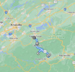
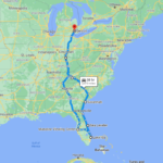
Alaska: The Special Case
Yes, you can actually drive from Ohio to Alaska. But let’s be real — this is a completely different kind of trip.
- Total miles: approximately 3,925 one way
- Drive time: roughly 65 hours
- Passport required: you drive through 4 Canadian provinces/territories
- Route: Ohio → Indiana → Illinois → Wisconsin → Minnesota → North Dakota → Saskatchewan → Alberta → British Columbia → Yukon → Alaska
- Estimated gas cost: approximately $1,011 one way
Ohio actually has a pretty efficient Alaska route compared to other states — at 3,925 miles, it’s shorter than Maine’s (4,458 mi), shorter than Florida’s (4,765 mi), and slightly shorter than Texas’s (4,006 mi). The route cuts north through the Midwest, into Canada at the North Dakota/Saskatchewan border, then west across the prairie provinces to BC, Yukon, and finally Alaska.
Worth knowing: some states issue Enhanced Driver’s Licenses that allow land border crossings into Canada without a full passport. Ohio is one of them — check with the BMV before you go.
Frequently Asked Questions
Gas prices are based on AAA state averages from May 2026. Gas prices change constantly — for the most current numbers before your trip, check aaa.com/gas.
It’s a solid average for a typical car, SUV, or minivan on the highway. If you drive a truck you might be closer to 15 MPG; if you drive a smaller sedan you might hit 30 MPG. To calculate your own cost: take the miles shown for your destination, divide by your actual MPG, and multiply by the destination state’s gas price shown in the table.
No — all numbers are one way. Double it for a rough round trip estimate, though your return cost may vary a little depending on gas prices when you travel.
Using the geographic center of each state gives everyone a fair, consistent target. If we picked major cities, some states would look artificially cheap or expensive just because their biggest city happens to be near a border. The center point puts every state on equal footing.
From Mansfield, OH to central New York state (Cooperstown), yes — 7h 33m to be exact. New York City itself is a bit longer (roughly 8 to 8.5 hours from Mansfield depending on traffic and route). Either way, “a day’s drive to NYC” is real for Ohio drivers in a way it isn’t for most other states.
Yes! The mileage and drive time are the same in both directions, and the gas cost is close enough to be useful since the same states are in the route either way. If you’re looking at the cost to drive to Ohio from, say, Florida, find Florida in the table — that $219 number works for both directions, give or take a few dollars depending on where you fill up. Ohio itself runs about $4.62 per gallon if you’re filling up here.
Mansfield sits at the geographic center of Ohio — using one fixed launch point keeps every state’s number fair and apples-to-apples. If you’re starting from Cleveland, Columbus, Cincinnati, Toledo, or Akron, just add or subtract an hour and a few gallons for the drive to or from Mansfield. You can ballpark it pretty easily from the table.
Because gas actually costs different amounts in different states. California regularly runs over $6 a gallon, with Washington and Oregon close behind. Georgia, Texas, and Mississippi often sit closer to $4. If we used Ohio’s price for the entire trip, you’d get a completely wrong number for anything west of the Mississippi or up the Northeast Corridor. We use the actual price in each state for the miles you drive there.
Ready to start planning?
Now that you know what gas will cost, you can stop wondering and start planning. Bookmark this map for next time — and if it saved you some math, share it with the friend who keeps threatening to “just drive to Florida this winter” but won’t commit until they know the number.