


Driving from North Carolina, gas to the closest state (South Carolina) costs as little as $31 one way. To the far Pacific coast (Washington or Oregon), you’re looking at about $556. Most road trips from North Carolina land somewhere between those two numbers, and the exact cost comes down to where you’re headed and current AAA gas prices.
We built an interactive map that answers that question for every single state — at a glance.
Unlike most gas calculators that spit out one number based on a single national average, this map uses each state’s actual current gas price for the miles you drive through it. So the cost you see for California uses California’s expensive gas, and the cost for Tennessee uses Tennessee’s cheaper gas. The result is a more honest look at what your trip will really cost. There’s also an MPG box on the map — type in your car’s real number and every cost updates instantly.
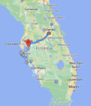
North Carolina to anywhere
AAA June 2026 · One way · Hover any state
Total: ~4,462 miles · ~72 hours · Passport required · Route through 4 Canadian provinces/territories · Estimated gas cost ~$1,080 one way
How We Calculate Gas Cost From North Carolina To Every State
A few things worth knowing before you read the numbers:
- Vehicle: 20 MPG — a reasonable average for most cars and SUVs (use the MPG box on the map to set your own)
- Routes: Actual driving routes from Asheboro, not straight-line distance
- Destination: The geographic center city of each state
- Gas prices: Each state’s own AAA average — not a national average
- Data source: AAA Gas Prices, June 2026
- Direction: One way from Asheboro, North Carolina
This means if you’re driving to Tennessee, we used Tennessee’s gas price for the miles you’re in Tennessee — not North Carolina’s price for the whole trip. That’s what makes this different from a standard calculator.
Cheapest And Most Expensive Drives From North Carolina
- South Carolina is the cheapest drive at $31 one way — under 3 hours and just 166 miles, practically next door.
- Washington is the most expensive at $556 — the far Northwest corner, roughly 2,700 miles out.
- Texas is the best value for the distance: $244 for 1,333 miles, riding cheap southern gas almost the whole way.
- California has the priciest gas in the country ($5.76 a gallon) but isn’t the priciest drive — Washington and Oregon both edge it out, simply because they’re farther.
- Tennessee is the sweet spot at $88 — about 7 hours and 477 miles, an easy run toward Nashville.
How Long Does It Take To Drive From North Carolina To Every State?
Gas cost is only half the story. Before you commit to a road trip, you also need to know how many hours you’ll be sitting in the car. We mapped that too — from a quick 2h50m hop to South Carolina all the way out to 40 hours to the Pacific.
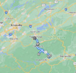
North Carolina to anywhere
AAA June 2026 · One way · Hover any state
Total: ~4,462 miles · ~72 hours · Passport required · Route through 4 Canadian provinces/territories · Estimated gas cost ~$1,080 one way
Gas Cost And Drive Time From North Carolina To Every State
Sorted by cost, lowest to highest. All prices one way from Asheboro, North Carolina, at 20 MPG.
| State | Gas Cost | Drive Time | Miles | Gas Price There |
|---|---|---|---|---|
| South Carolina | $31 | 2h 50m | 166 mi | $3.70 |
| Virginia | $35 | 3h 5m | 184 mi | $3.83 |
| West Virginia | $54 | 4h 35m | 280 mi | $4.04 |
| Maryland | $66 | 5h 25m | 351 mi | $3.85 |
| Georgia | $69 | 5h 55m | 368 mi | $3.77 |
| Kentucky | $80 | 7h 40m | 438 mi | $3.65 |
| Delaware | $81 | 6h 45m | 429 mi | $3.82 |
| Pennsylvania | $82 | 6h 40m | 419 mi | $4.23 |
| Tennessee | $88 | 7h 20m | 477 mi | $3.64 |
| Alabama | $92 | 7h 55m | 493 mi | $3.70 |
| Ohio | $96 | 7h 40m | 486 mi | $4.09 |
| New Jersey | $102 | 8h 20m | 526 mi | $4.13 |
| Florida | $108 | 8h 40m | 575 mi | $3.86 |
| Indiana | $110 | 9h | 568 mi | $3.36 |
| Mississippi | $124 | 10h 50m | 668 mi | $3.68 |
| Connecticut | $130 | 11h 5m | 662 mi | $4.24 |
| New York | $135 | 10h 40m | 670 mi | $4.38 |
| Michigan | $136 | 10h 40m | 676 mi | $4.20 |
| Rhode Island | $144 | 11h 15m | 726 mi | $4.08 |
| Massachusetts | $146 | 12h 15m | 736 mi | $4.20 |
| Illinois | $152 | 12h 5m | 775 mi | $4.40 |
| Arkansas | $159 | 13h 10m | 865 mi | $3.70 |
| Louisiana | $164 | 13h 55m | 884 mi | $3.67 |
| New Hampshire | $172 | 13h 15m | 860 mi | $4.17 |
| Vermont | $176 | 13h 10m | 873 mi | $4.32 |
| Missouri | $182 | 14h 30m | 952 mi | $3.76 |
| Wisconsin | $200 | 15h 45m | 1,032 mi | $3.89 |
| Maine | $204 | 16h 20m | 1,011 mi | $4.17 |
| Iowa | $207 | 16h 15m | 1,056 mi | $3.73 |
| Oklahoma | $208 | 17h | 1,139 mi | $3.58 |
| Kansas | $229 | 18h 25m | 1,201 mi | $3.74 |
| Texas | $244 | 19h 50m | 1,333 mi | $3.54 |
| Minnesota | $248 | 19h 35m | 1,280 mi | $3.88 |
| Nebraska | $264 | 21h 15m | 1,381 mi | $3.91 |
| North Dakota | $298 | 23h | 1,541 mi | $3.86 |
| South Dakota | $299 | 22h 50m | 1,539 mi | $3.98 |
| New Mexico | $307 | 25h | 1,673 mi | $3.94 |
| Colorado | $322 | 26h | 1,678 mi | $4.13 |
| Wyoming | $344 | 27h | 1,777 mi | $4.23 |
| Montana | $397 | 30h | 2,023 mi | $4.25 |
| Arizona | $399 | 31h | 2,109 mi | $4.44 |
| Utah | $411 | 31h | 2,098 mi | $4.31 |
| Idaho | $463 | 35h | 2,326 mi | $4.43 |
| Nevada | $489 | 37h | 2,428 mi | $4.93 |
| California | $542 | 38h | 2,626 mi | $5.76 |
| Oregon | $554 | 40h | 2,696 mi | $5.01 |
| Washington | $556 | 40h | 2,707 mi | $5.53 |
| Alaska ⚠️ | ~$1,080 | ~72h | ~4,462 mi | varies* |
*Alaska gas price varies by Canadian province; estimate uses a blended rate. All figures one way from Asheboro, NC, at 20 MPG. AAA averages, June 2026.
Times are no traffic, direct route, rounded to the nearest 5 minutes. Real world drive time will vary — budget extra for stops, construction, and the inevitable “we need snacks” moment 40 miles before the exit. 😄
Can You Drive From North Carolina To Alaska?
Yes, you can actually drive from North Carolina to Alaska. But let’s be real — this is a completely different kind of trip.
- Total miles: approximately 4,462 one way
- Drive time: roughly 72 hours
- Passport required: you drive through 4 Canadian provinces
- Route: North Carolina → Virginia → West Virginia → Ohio → Indiana → Illinois → Wisconsin → Minnesota → North Dakota → Saskatchewan → Alberta → British Columbia → Yukon → Alaska
- Estimated gas cost: approximately $1,080 one way
British Columbia is typically the most expensive leg of the Canadian portion, and the sheer distance is what drives the total up. The Canadian provinces are surprisingly reasonable on their own — it’s just a LOT of road.
Worth knowing: some states issue Enhanced Driver’s Licenses that allow land border crossings into Canada without a full passport. Check with your state’s DMV before you go.
Frequently Asked Questions
Because gas actually costs different amounts in different states. California and Washington run over $5.50 a gallon. Texas, Oklahoma, and Tennessee often sit under $3.65. If we used North Carolina’s price for the entire trip, you’d get a completely wrong number for anything far from home. We use the actual price in each state for the miles you drive there.
Using the geographic center of each state gives everyone a fair, consistent target. If we picked major cities, some states would look artificially cheap or expensive just because their biggest city happens to sit near a border. The center point puts every state on equal footing.
No — all numbers are one way. Double it for a rough round trip estimate, though your return cost may vary a little depending on gas prices when you travel.
Use the MPG box above the map — type your number and every cost updates instantly.
Gas prices are based on AAA state averages from June 2026. Gas prices change constantly — for the most current numbers before your trip, check aaa.com/gas.
Ready To Start Planning?
Now that you know what gas will cost, it’s time to figure out where to actually go. Check out our North Carolina road trip guides for ideas on where to stop, what to see, and how to make the most of your drive — whether you’re chasing the Blue Ridge Parkway, the Outer Banks, or somewhere brand new.
Hi, I’m Alice. I’ve been running Road Trip Owl for five years and taking 6+ multi-day road trips a year (plus more weekend escapes than I can count). These maps come from the real road — real routes, real prices, no national averages.