


This map shows every winter trouble road in the US in one place: 153 mountain passes, lake-effect snow belts, blizzard closures, ice storm zones, and bridges that close. It also shows average snowfall by month at about 4,400 NOAA weather stations, so you can see where snow usually falls before you plan a route.
Tap any road to see why it’s a problem, the chain rules, a town to wait out a storm, and a safer way around.

Alice’s Pick
My road trip secret for a car that stays clean.
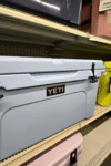
Our roof box holds the stuff we only need now and then: beach gear for that one beach day, dirty laundry, shopping bags, even shells, so the car doesn’t smell like the ocean. In winter it’s wet boots and snowy gear. More room inside, less mess.
Tap a road marker for the full card, or tap a state to see its roads. Snow dots are NOAA weather stations showing the 1991–2020 average for the month you pick. They show where snow usually falls, not a forecast.
Chain and traction rules
When a sign says chains are required, you can't drive past it without them (or the tires and drive type the state allows). Many rental car contracts don't allow chains, so check yours before a mountain trip.
Every road on the map
Listed by state. States not listed have no named winter trouble spot, so general winter driving advice applies.
Please read: We researched every road on this map using state DOTs, the National Weather Service, and news reports, and put it all in one place to help you plan. We may have missed a road or gotten something wrong, and conditions change with every storm. This map is a planning tool, not a forecast or official road information. Always check the state's road conditions before you leave and follow posted signs, chain rules, and closures. Road Trip Owl isn't responsible for travel decisions made using this map. Snowfall: NOAA U.S. Climate Normals, 1991–2020.
How do you use the winter road map?
- Pick a month from October to April. The blue dots show average snowfall for that month. Darker blue means more snow.
- Tap a road marker to open its card. Each card tells you why the road is a problem, where to wait out a storm, the safer option, and the state’s chain rules.
- Tap a state to see every trouble road in it, plus its road conditions link.
- Turn trouble types on and off with the buttons above the map. Planning around ice? Turn off everything but ice.
- On your phone, scroll down to the road list. Search any road, town, or state.
What do the trouble types mean?
- Mountain pass or grade: steep climbs with snow, chain rules, and sometimes avalanche closures.
- Lake-effect snow belt: sudden whiteouts downwind of the Great Lakes. Roads can go from clear to zero visibility in minutes.
- Wind and blizzard closures: open, flat roads that close when wind blows snow across them, even after the snow stops.
- Ice storm zone: places where freezing rain shuts roads down, mostly in the South, where ice is harder to handle than snow.
- Heavy snow and squalls: short, intense bursts of snow that cause chain-reaction crashes.
- Fog and ice: mountain stretches where thick fog and ice show up together.
- Bridge that closes: long, high bridges that close for wind or falling ice when the roads on both ends are fine.
- Closed all winter: scenic roads that close for the whole season. Don’t plan a winter route over them.
How much snow falls where you’re going?
The snow layer uses NOAA’s 30-year averages (1991 to 2020). It shows what a normal month looks like, not this winter’s forecast.
- The snowiest places are in the Sierra Nevada, the Rockies, the Cascades, and the lake-effect belts downwind of Lake Superior, Lake Michigan, Lake Erie, and Lake Ontario.
- January and February are the snowiest months across most of the country.
- Mountain snow starts as early as October and can last into May.
- The South rarely gets snow. Ice is the bigger risk there.
Michigan winter road conditions
Michigan’s trouble is lake-effect snow. Whiteouts off Lake Michigan and Lake Superior cause sudden pileups, and two big bridges close in bad weather.
- I-94, Benton Harbor to Kalamazoo: repeated whiteout pileups of 14 to 70 vehicles. Wait it out in Kalamazoo or Benton Harbor.
- I-196, Benton Harbor to Grand Rapids: a 100+ vehicle whiteout pileup near Hudsonville. Wait it out in Holland or Grand Rapids.
- I-96, Grand Rapids to Muskegon, and US-131 in west Michigan: both hit hard in lake-effect bursts.
- I-75, Grayling to Gaylord: the snow belt between the lakes. US-23 along Lake Huron usually gets less.
- US-2 and M-28 in the Upper Peninsula: heavy Lake Superior snow and long stretches between towns. M-94 is the posted detour when M-28 closes.
- Mackinac Bridge: closes when ice falls off the cables, once for a record 30 hours. No detour. Wait it out in Mackinaw City or St. Ignace.
- Zilwaukee Bridge (I-75, Saginaw): freezing rain closed it in December 2025. I-675 goes around it.
Montana winter road conditions
Montana’s trouble is mountain passes on I-90 and blowing snow on I-15.
- I-90 over Homestake Pass (Butte) and Bozeman Pass: snow and wind. Wait it out in Butte or Bozeman.
- I-90 over Lookout Pass: snow and ice on the main northern route. Wait it out in Missoula or Wallace, Idaho.
- I-15 over Monida Pass: blowing snow has closed up to 64 miles at once. Wait it out in Dillon or Idaho Falls.
- Closed all winter: Going-to-the-Sun Road in Glacier and the Beartooth Highway.
- Chains: Montana posts chain rules pass by pass. Four-wheel drive vehicles are exempt under state law, but follow the posted signs.
Wisconsin winter road conditions
Wisconsin’s trouble spot is the far north, along Lake Superior.
- US-2 around Hurley and the Lake Superior shore: heavy lake-effect snow in the Gogebic snow belt. Drive it in daylight and wait it out in Ironwood or Ashland.
- The rest of Wisconsin has no named trouble spot, so general winter driving advice applies.
Which states have chain laws?
The western mountain states post their own chain and traction rules. The map lists each one: California, Colorado, Oregon, Washington, Utah, Nevada, Wyoming, Idaho, and Montana.
- California uses R1, R2, and R3 chain controls.
- Colorado has a Traction Law and a Chain Law. The Traction Law is always on for I-70 from Dotsero to Morrison, Sept 1 to May 31.
- Utah has a Traction Law on canyon and pass routes that can start up to 24 hours before a storm.
- Idaho’s chain law only covers heavy commercial trucks.
- Rental cars: many rental contracts don’t allow chains. Check yours before a mountain trip.
What’s the safest way to drive across the country in winter?
- I-10 across the South is the lowest-risk way west. Low risk isn’t no risk, though: even I-10 has iced in Texas and Louisiana.
- I-40 isn’t a safe southern swap. Flagstaff and the Texas Panhandle both see snow and blizzard closures.
- I-80 and I-70 cross the worst of the Rockies and Wyoming’s wind closures.
- Driving to Florida, I-77 through West Virginia and Virginia has mountain stretches and the Fancy Gap fog zone. Check the map before you pick between I-75 and I-77.
FAQ
Yes. The snow layer on our winter road map shows NOAA’s 30-year average snowfall for each month from October to April at about 4,400 US weather stations. Pick a month to see where snow usually falls.
Use the state’s official road conditions site the morning you leave. Every state on our map has a road conditions button that links to it. Check again before you cross a mountain pass.
Don’t wait it out in your car on the shoulder if you can avoid it. Stop at the last town before the closure and get a room or a warm spot. Every road on our map lists a town to wait in.
Do
Sometimes. California, Colorado, Oregon, Washington, Utah, Nevada, Wyoming, and Montana post chain or traction rules on mountain roads. Four-wheel drive or all-wheel drive with good snow tires passes most levels, but you may still need to carry chains.
There’s no single one. I-80 over Donner Summit gets 30+ feet of snow a winter. Wyoming’s I-80 closes for wind. Michigan’s I-196 had a 100+ vehicle whiteout pileup. Each danger is different, which is why the map sorts roads by trouble type.
Plan your winter drive
Check the map before you pick your route, not the morning you leave. Then check the state’s road conditions before you go. If you’re headed somewhere snowy, our Does It Snow in California? guide shows month-by-month snowfall for the Sierra, Big Bear, and Mount Shasta.
Please read: We researched every road on this map using state DOTs, the National Weather Service, and news reports, and put it all in one place to help you plan. We may have missed a road or gotten something wrong, and conditions change with every storm. This map is a planning tool, not a forecast or official road information. Always check the state’s road conditions before you leave and follow posted signs, chain rules, and closures. Road Trip Owl isn’t responsible for travel decisions made using this map.
About the author
Hi, I’m Alice. I’ve been running Road Trip Owl for five years and taking 6+ multi-day road trips a year. I live in northern Michigan, so I know snow and lake-effect whiteouts. Mountain passes, chain laws, and roads that close for days are a different story. I built this map while planning my own winter drive out West, because I couldn’t find all of it in one place. It covers every state, because I know I’m not the only one who’s nervous about it.